


Byron-Chester-Hubbell Precinct, Thayer County, Nebraska
About
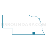
Outline

Summary
| Unique Area Identifier | 613978 |
| Name | Byron-Chester-Hubbell Precinct |
| County | Thayer County |
| State | Nebraska |
| Area (square miles) | 143.83 |
| Land Area (square miles) | 143.20 |
| Water Area (square miles) | 0.63 |
| % of Land Area | 99.56 |
| % of Water Area | 0.44 |
| Latitude of the Internal Point | 40.03838580 |
| Longtitude of the Internal Point | -97.58590060 |
Maps


Graphs
Select a template below for downloading or customizing gragh for Byron-Chester-Hubbell Precinct, Thayer County, Nebraska


Neighbors
Neighoring Voting District (by Name) Neighboring Voting District on the Map
- Albion Township Voting District, Republic County, KS
- Alexandria-Gilead Precinct, Thayer County, NE
- Big Bend Township Voting District, Republic County, KS
- Buck-Ant-End Precinct, Jefferson County, NE
- Deshler Precinct, Thayer County, NE
- Hardy Precinct, Nuckolls County, NE
- Hebron South Precinct, Thayer County, NE
- Liberty Township Voting District, Republic County, KS
- Lin-Mer-Fby-Rich Precinct, Jefferson County, NE
- Rose Creek Township Voting District, Republic County, KS
- Spring Creek Precinct, Nuckolls County, NE
- Union Township Voting District, Washington County, KS
- Washington Township Voting District, Republic County, KS
Top 10 Neighboring County Subdivision (by Population) Neighboring County Subdivision on the Map
- Deshler precinct, Thayer County, NE (981)
- Chester precinct, Thayer County, NE (696)
- Alexandria precinct, Thayer County, NE (431)
- Hardy precinct, Nuckolls County, NE (340)
- Hebron South precinct, Thayer County, NE (206)
- Spring Creek precinct, Nuckolls County, NE (194)
- Big Bend township, Republic County, KS (177)
- Albion township, Republic County, KS (142)
- Buckley precinct, Jefferson County, NE (140)
- Lincoln precinct, Jefferson County, NE (108)
Top 10 Neighboring Place (by Population) Neighboring Place on the Map
Top 10 Neighboring Unified School District (by Population) Neighboring Unified School District on the Map
- Fairbury Public Schools, NE (5,796)
- Republic County - Hillcrest Rural Schools Unified School District 109, KS (3,825)
- Superior Public Schools, NE (2,985)
- Thayer Central Community Schools, NE (2,761)
- North Central - Washington Schools Unified School District 108, KS (2,652)
- Deshler Public Schools, NE (1,402)
Top 10 Neighboring State Legislative District Lower Chamber (by Population) Neighboring State Legislative District Lower Chamber on the Map
Top 10 Neighboring State Legislative District Upper Chamber (by Population) Neighboring State Legislative District Upper Chamber on the Map
- State Senate District 21, KS (61,803)
- State Senate District 32, NE (32,865)
- State Senate District 38, NE (32,734)
Top 10 Neighboring 111th Congressional District (by Population) Neighboring 111th Congressional District on the Map
Top 10 Neighboring Census Tract (by Population) Neighboring Census Tract on the Map
- Census Tract 9636, Jefferson County, NE (3,294)
- Census Tract 9786, Washington County, KS (3,233)
- Census Tract 9631, Thayer County, NE (2,771)
- Census Tract 9632, Thayer County, NE (2,457)
- Census Tract 9600, Nuckolls County, NE (2,394)
- Census Tract 9782, Republic County, KS (1,673)
- Census Tract 9781, Republic County, KS (1,133)
Top 10 Neighboring 5-Digit ZIP Code Tabulation Area (by Population) Neighboring 5-Digit ZIP Code Tabulation Area on the Map
- 68352, NE (5,222)
- 66935, KS (2,563)
- 68370, NE (2,075)
- 68340, NE (992)
- 68327, NE (299)
- 68943, NE (269)
- 68325, NE (232)
- 66964, KS (204)
- 66959, KS (203)
- 68974, NE (184)